Google Maps offers a nifty web-only feature that can make it easier for you to plan trips. Here’s how to turn it on and use it.
Did you know Google Maps has a feature called Travel Time that lets you to see approximately how far you can travel in a given time limit?
As of now, this feature works with Walking and Driving navigation, but not Cycling or Public Transportation. It’s also only available in the web version of Google Maps, not the Android or iOS apps.
Here’s how you can turn on Travel Time in Google Maps and what makes it such a useful feature to start using.
How to enable Travel Time
Navigate to maps.google.com in your web browser (you don’t need to be logged in with your Google account), then hover over the bottom-left icon labeled Layers to open a menu.
In the hover menu, click More, then look under the Map Tools section and click on Travel Time to enable the feature:
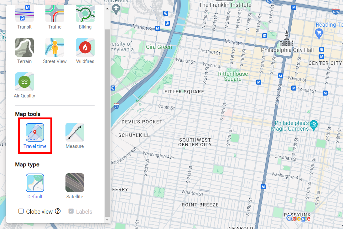
Joel Lee / IDG
Once you enable Travel Time, you’ll see a new panel appear at the bottom-center of Google Maps, and this panel will have grayed-out options for selecting a time limit and method of travel:
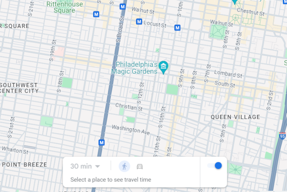
Joel Lee / IDG
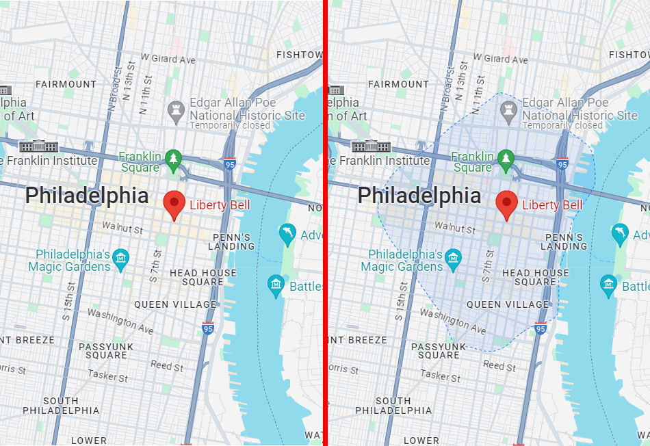
Now click anywhere on the map to set a starting location. Once a starting location is set, you’ll be able to select a time limit and method of travel, which will then reveal how far you can go in that time.
How to use the Travel Time feature
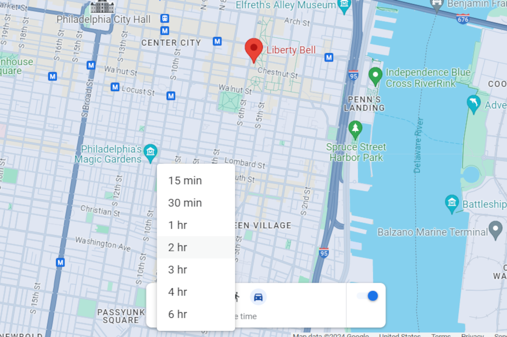
Joel Lee / IDG
With Travel Time, you can choose the following time limits when Walking is the method of travel:
- 15 minutes
- 30 minutes
And these time limits with Driving selected:
- 15 minutes
- 30 minutes
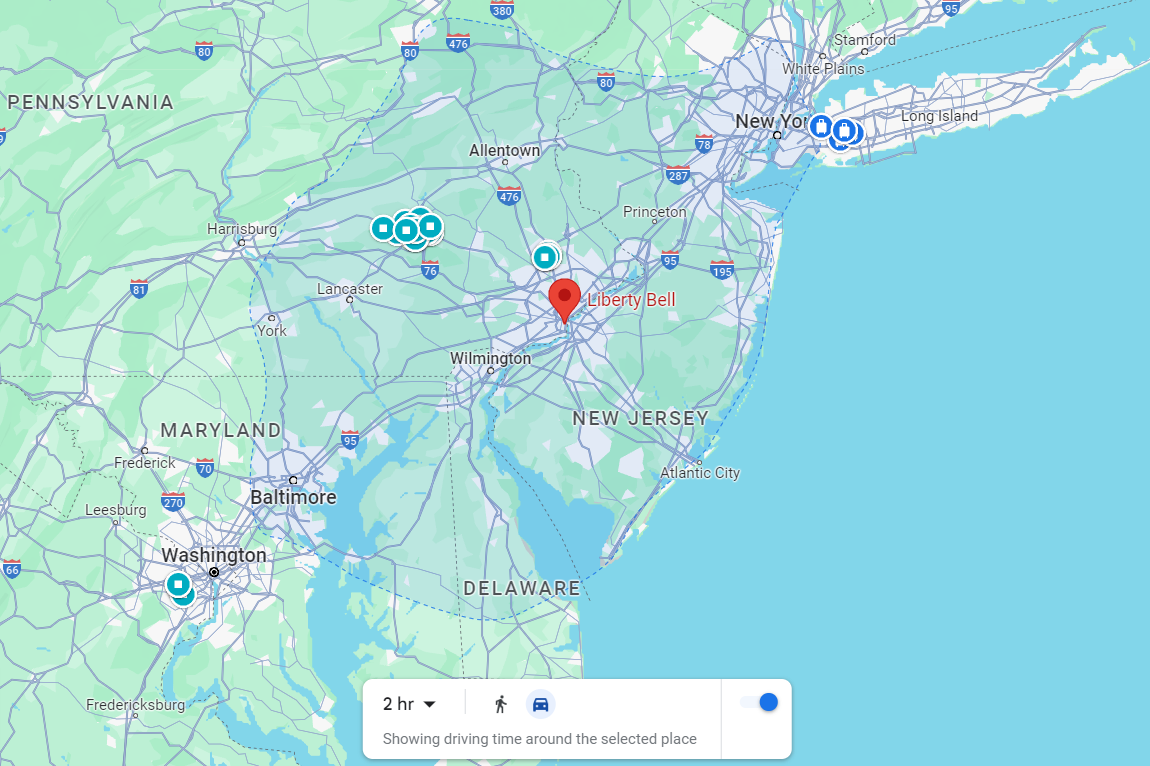
- 1 hour
- 2 hours
- 3 hours
- 4 hours
- 6 hours
You’ll see a shaded region on the map that shows everywhere you could travel within the time limit via the method of travel. The shaded region won’t necessarily be a circle because different paths may allow for greater travel in certain directions (or be blocked off entirely).
Joel Lee / IDG
Depending on the time limit selected, you may have to zoom out of the map to be able to view the entire shaded region:
Joel Lee / IDG
There are two drawbacks to Travel Time as of this writing:
- The estimate doesn’t take into account traffic conditions and only represents a general idea of where you could go. It may be inaccurate during rush hour or if there’s an accident somewhere.
- Not every location currently has Travel Time data, and some locations may only have Driving data but not Walking data.
Despite these shortcomings, the Travel Time feature is pretty cool to play around with and can be useful for getting a general idea of where you could possibly go given certain parameters.